|
| 1859-Barcelona-02-007 |
|
1
|
|
Manuel Antonio Rodríguez (copied after)
|
|
Unknown
|
|
|
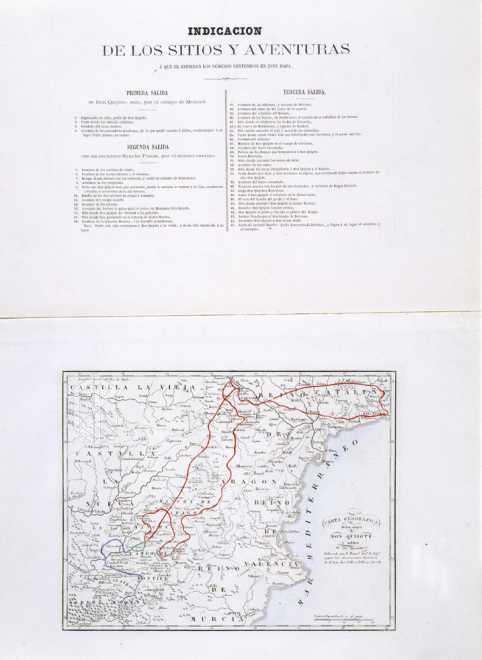
| CARTA GEOGRAFICA de los viajes de DON QUIJOTE Y SITIOS de sus aventuras |
| |
|
|
| |
|
|
Map
|
Burin engraving
Etching (acquaforte)
|
| Black and white |
| II |
| f.p. 472 |
| 210 x 270 |
| 305 x 436 |
The map has been done "según las observaciones históricas de D. Juan Antonio Pellicer, Bibliotecario de S. M.".
It includes "INDICACION DE LOS SITIOS Y AVENTURAS Á QUE SE REFIEREN LOS NUMEROS CONTENIDOS EN ESTE MAPA" (p. 472). First sally: 1 - 4; second sally: 5 - 16; Third sally: 17 - 45. |
1 - It is a copy of the map appeared in Madrid: Sancha, 1797 - 1798 and Madrid: Sancha, 1798 - 1799. Now, the references to places and adventures do not appear inside the map.
2 - The routes are hand-colored. |