click to enlarge
Excellent engraving.
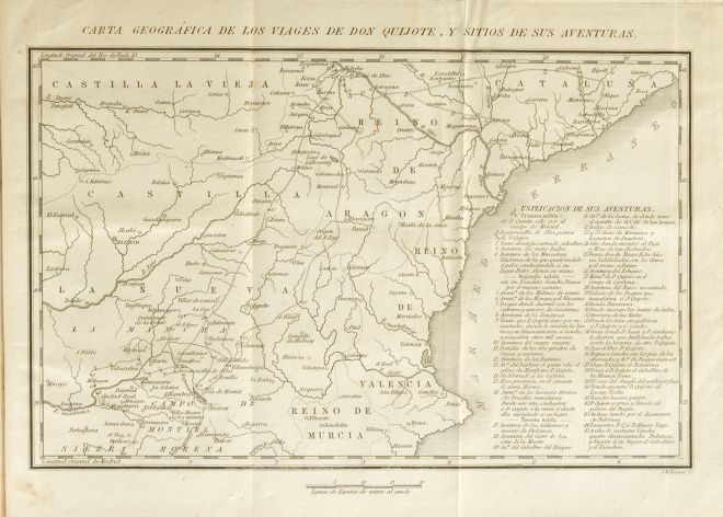
2 - Based on the map for Madrid: Ibarra, 1780.
|
click to enlarge |
|
| Image | 1836-Boston-Perkins-01-006-m |
| Illustration No. | 1 |
| Illustrator | Unknown |
| Engraver | George W. Boynton |
| Lithographer | |
| Title Caption | CARTA GEOGRÁFICA DE LOS VIAGES DE DON QUIJOTE, Y SITIOS DE SUS AVENTURAS. |
| Title Supplied | |
| Part | |
| Chapter | |
| Subject | |
| Illustration Type |
Map |
| Technique |
Etching (acquaforte) |
| Color | Black and white |
| Volume | I |
| Page Number | f.p. 436 |
| Image Dimension | 143 x 224 |
| Page Dimension | 191 x 250 |
| Commentary | The map includes an "ESPLICACION DE SUS AVENTURAS" for first sally (1 - 4), second sally (5 - 16) and third sally (17 - 45).
Excellent engraving. |
| Notes | 1 - "Tambien se hallará en esta edicion [...] un Mapa de una porcion del reino de España que comprende los parajes por donde anduvo Don Quijote y los sitios de sus aventuras, ejecutado conforme ál que se contiene en la arriba dicha edicion de Arrieta [Paris: 1826], pero mucho mas primoroso y correcto, por G. W. Boynton, hábil grabador de esta capital" ("Advertencia del Editor", p. v, vol. I).
2 - Based on the map for Madrid: Ibarra, 1780. |