click to enlarge
|
click to enlarge |
|
| Image | 1887-1894-Madrid-Rojas-01-003-m |
| Illustration No. | 1 |
| Illustrator | Unknown |
| Engraver | Unknown |
| Lithographer | |
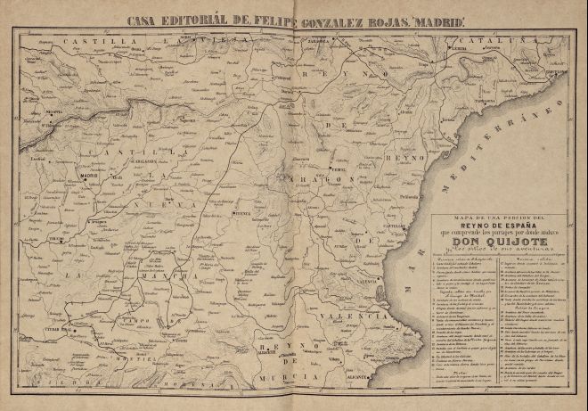
| Title Caption | MAPA DE UNA PORCION DEL REYNO DE ESPAÑA que comprenden los parages por donde anduvo DON QUIJOTE y los sitios de sus aventuras. |
| Title Supplied | |
| Part | |
| Chapter | |
| Subject | |
| Illustration Type |
Map |
| Technique |
Process / Photomechanical technique |
| Color | Black and white |
| Volume | I |
| Page Number | Between pages 8 and 9 |
| Image Dimension | 275 x 418 |
| Page Dimension | 315 x 440 |
| Commentary | Map of Central and East Spain including don Quixote's route and places of his adventures (first sally: 1-4; second sally: 5-16; third sally: 17-35). |
| Notes | 1 - Based on Tomás López' map for Madrid: Ibarra, 1780. |