click to enlarge
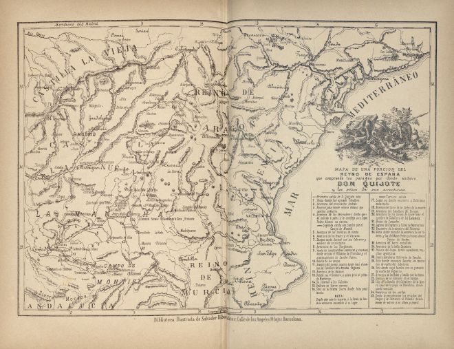
It includes the same references to 35 spots (first sally: 4; second sally: 12; third sally: 19) but a different ornamental vignette with don Quixote's arms.
|
click to enlarge |
|
| Image | 1882-Barcelona-Manero-02-008-m |
| Illustration No. | 1 |
| Illustrator | Unknown |
| Engraver | Unknown |
| Lithographer | |
| Title Caption | MAPA DE UNA PORCION DEL REYNO DE ESPAÑA que comprende los parages por donde anduvo DON QUIJOTE y los sitios de sus aventuras |
| Title Supplied | |
| Part | |
| Chapter | |
| Subject | |
| Illustration Type |
Map |
| Technique |
Process / Photomechanical technique |
| Color | Black and white |
| Volume | Tome II (bound with tome I in 1 volume) |
| Page Number | Between 378 and 379 |
| Image Dimension | 256 x 362 (double page) |
| Page Dimension | 306 x 400 (double page) |
| Commentary | Map of Central and East Spain with don Quixote's route based on the map published in Madrid: Ibarra, 1780.
It includes the same references to 35 spots (first sally: 4; second sally: 12; third sally: 19) but a different ornamental vignette with don Quixote's arms. |
| Notes | 1 - Same map first published in Barcelona: L. Obradors & P. Sulé, 1876. |