click to enlarge
2 - Same plate first used for Paris: Julio Didot Mayor, 1827.
|
click to enlarge |
|
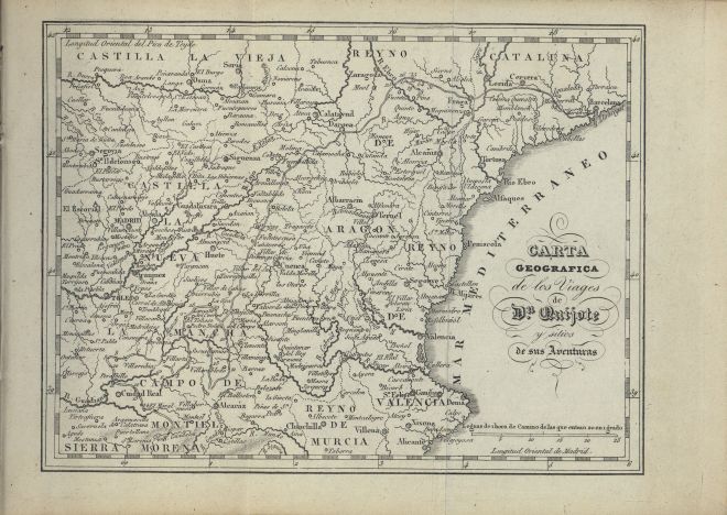
| Image | 1832-Paris-02-007-m |
| Illustration No. | 1 |
| Illustrator | Manuel Antonio Rodríguez (copied after) |
| Engraver | Unknown |
| Lithographer | |
| Title Caption | CARTA GEOGRAFICA de los Viages de Dn. Quijote y sitios de sus Aventuras |
| Title Supplied | |
| Part | |
| Chapter | |
| Subject | |
| Illustration Type |
Map |
| Technique |
Burin engraving |
| Color | Black and white |
| Volume | II |
| Page Number | Last page |
| Image Dimension | 103 x 137 |
| Page Dimension | 120 x 164 |
| Commentary | Map of Spain with don Quixote's route: first sally: 1 - 4; second sally: 5 - 16; third sally: 17 - 35. |
| Notes | 1 – Copy after the map for Madrid: Imprenta Real, 1797-98.
2 - Same plate first used for Paris: Julio Didot Mayor, 1827. |