click to enlarge
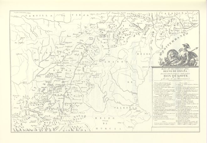
Obove the map legend, don Quixote's arms: barber basin (Mambrino's helmet), armour, shield of the Knight of the sad countenance, shield with a lion...
|
click to enlarge |
|
| Image | 1842-Mexico-Cumplido-02-075-m |
| Illustration No. | 1 |
| Illustrator | Tomás López (based on) |
| Engraver | |
| Lithographer | Oficina Litotipográfica de Miguel Ángel Porrúa |
| Title Caption | MAPA DE UNA PORCION DEL REINO DE ESPAÑA Que comprende los parages por donde anduvo DON QUIJOTE y los sitios de sus Aventuras. |
| Title Supplied | |
| Part | |
| Chapter | |
| Subject | |
| Illustration Type |
Map |
| Technique |
Process / Photomechanical technique |
| Color | Black and white |
| Volume | II |
| Page Number | f.p. 470 |
| Image Dimension | 143 x 224 |
| Page Dimension | 175 x 250 |
| Commentary | Map with a portion of Spain (central and East) including 35 points of don Quixote's route (since the inn where he was knighted); first sally (1-4), second sally (5-16), third sally (17-35).
Obove the map legend, don Quixote's arms: barber basin (Mambrino's helmet), armour, shield of the Knight of the sad countenance, shield with a lion... |
| Notes | 1 - Based on the map designed by Tomás López, geographer of His Majesty, according to the observations done on the spot by José de Hermosilla, captain of engineers, for Madrid: Ibarra, 1780 (and later editions). |