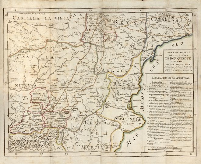
click to enlarge |
|
Image | 1797-1798-Madrid-Sancha-05-013-m |
Illustration No. | 1   |
Illustrator | Manuel Antonio Rodríguez |
Engraver | Unknown |
Lithographer | |
Title Caption | CARTA GEOGRÁFICA DE LOS VIAGES DE DON QUIXOTE Y SITIOS DE SUS AVENTURAS |
Title Supplied | |
Part | |
Chapter | |
Subject | |
Illustration Type |
Map |
Technique |
Burin engraving |
Color | Colored |
Volume | V |
Page Number | f.p. 468 |
Image Dimension | 286 x 364 |
Page Dimension | 326 x 390 |
Commentary | "40. Carta Geografica de los Viajes de Don Quixote de la Mancha. P.II.T.II.al fin" ("Esplicacion de las estampas", vol. V, p. 436).
First sally: 1 - 4 (since Argamasilla de Alba); second sally: 5 - 16; third sally: 17 - 45. Marked in red: Priorato de San Juan, Campo de Montiel, Campo de Calatrava and Campo de Cariñena. Marked in yellow: Andalucía and Reino de Valencia. Marked in maroon: Reino de Murcia and Reino de Aragón. Marked in blue: Cataluña and Lagunas de Ruidera. Marked in green: Castilla La Nueva. Marked in orange: Castilla La Vieja. Marked in dark yellow: Don Quixote's route. |
Notes | 1 - "Según las observaciones históricas de D. Juan Antonio Pellicer, bibliotecario de S. M."
2 - Also included in Madrid: Sancha, 1798 - 1799. |